 17.2 km – Circular – Hard
  4-7h
4-7h  4.6
4.6
Book this Caminho. Check here
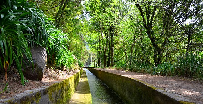
This walk follows the levadas of Serra and Norte between the elevations of 1000m and 1600m. It offers lovely views of the São Vicente valley, and passes areas of high altitude vegetation as well as Laurissilva forest.
Beginning at the regional highway E.R. 110 on the way up to Paul da Serra from Encumeada, this trail leads to the areas of Bica da Cana, Casa do Caramujo and Folhadal, coming to an end at regional road E.R. 228 at the Encumeada junction.
This path follows the levadas of Serra and Norte, between the elevations of 1000 and 1600 metres, crossing an excellent area of native high-altitude vegetation, as well as the native Laurisilva forest, an area that is part of the Natura 2000 Network.
Along the way, you will encounter magnificent views of the São Vicente Valley, as well as examples of the island’s architecture and heritage, as is the case of a “municipal path” – a section of a public pathway used by the islanders in travelling between the north and south sides of the island – paved with stone; the levadasand tunnels carved out of the rock that were built to carry the water from the north to the south side of the island.
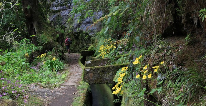
The route runs along the levada, although in some places you leave it to follow the stone pathway. When you reach the top of the footpath at Pináculo, you will have a view of the magnificent landscape of the Ribeira Brava Valley in the background and the Central Mountain Range, where the island’s two highest peaks stand out,
Pico do Areeiro (1817m) and Pico Ruivo (1861m).
Surround this levada is a vegetation rich in small endemic plants which are at the height of their beauty in the spring months: Madeiran orchids (Dactylorhiza foliosa), Canary buttercups (Ranunculus cortusifolius), easily recognised by their bright yellow flowers, Mandon’s chrysanthemum (Argyranthemum pinnatifidum), and geraniums (Geranium palmatum).

You will reach a point where the levada you have followed from the start divides into two branches. Follow the walkway at the side of the Levada do Norte, which is used to power the hydroelectric generating plant at Serra d’Água.
Cascades and tunnels are found all along this route and when you come out of the last tunnel, you reach Folhadal, a name referring to the abundance of Lily-of-the-valley trees (Port., folhados) (Clethra arborea) found here.
At Encumeada you can take PR 1.3 – Encumeada Footpath, which leads to Pico Ruivo.
Book this Caminho. Check here
Comment (0)